| |
Presidential
Candidate | Vice Presidential
Candidate | Political
Party | Popular Vote | Electoral Vote |
 | Franklin Roosevelt | Harry Truman | Democratic |
25,612,916 |
53.39% | 25,612,916 |
 | Thomas Dewey | John Bricker | Republican |
22,017,929 |
45.89% | 22,017,929 |
 | No Candidate | - | Texas Regulars |
135,439 |
0.28% | 135,439 |
| Norman Thomas | Darlington Hoopes | Socialist |
79,019 |
0.16% | 79,019 |
| Claude Watson | Andrew Johnson | Prohibition |
74,758 |
0.16% | 74,758 |
| Edward Teichert | Arla Albaugh | Socialist Labor |
45,188 |
0.09% | 45,188 |
| No Candidate | - | Southern Democrat |
7,799 |
0.02% | 7,799 |
| Write-ins | - | - |
2,263 |
0.00% | 2,263 |
| Gerald Smith | Henry Romer | America First |
1,781 |
0.00% | 1,781 |
 |
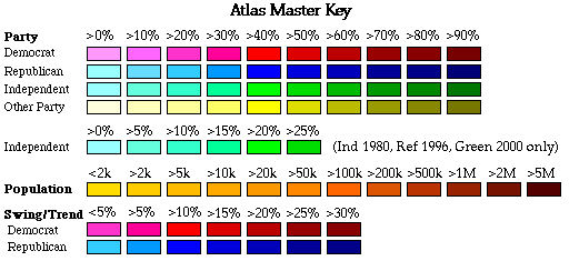
Map Key
| > 50% |
 |
 |
| > 60% |
 |
 |
| > 70% |
 |
 |
| > 80% |
 |
|
| > 90% |
 |
|
| Turnout
 |  |  |
|
| Maps | Map (m) |  | | Dem. (m) | | Rep. (m) | | Swg (m) | | Tnd (m) |
| |
| Demographic Data
| 1950 Population: | 151,325,798 | Enum. | 1950 Population Density: | 16.5 | persons/km2 | | 1940 Population: | 132,164,569 | Enum. | 1940 Population Density: | 14.4 | persons/km2 | | Total Electoral Vote: | 47977092 | | | Land Area (2000): | 9,161,889 | km2 | Annual Pop Growth Rate: | 1.4 | % |
| Election Data and Statistics:
- Data (Table) (m)
- Data (Graphs) (m)
- City and Town Data (m)
|
| | Election Tools
- Atlas Forum Image Code for Maps: County, Town, Tnd, Swg
Data Sources:
- Source for Popular Vote data:
- Source for Population data: U.S. Census Bureau.
| Results for and Individual :
|
|
| |
|
